Northamptonshire & Wales
Wales: Machynlleth
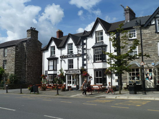
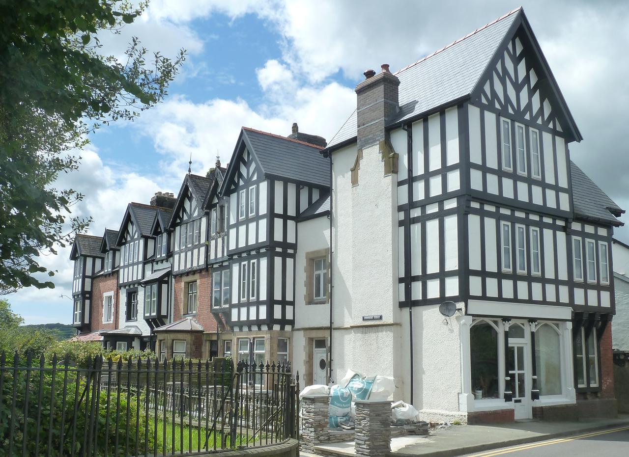
Machynlleth
(Aussprache) ist eine Kleinstadt im walisischen County Powys beziehungsweise im traditionellen County Montgomeryshire. Die Stadt ist ein Ferienort und Zentrum für die Schafzucht. Die Einheimischen nennen ihre Stadt auch einfach gerne Mach.
Machynlleth zählt 2.200 Einwohner und liegt im Tal des Dovey am Fuße einer Gruppe sanft geschwungener Hügel. Von hier aus ist sowohl die Region um den Cadair Idris, als auch das Plynlimon-Gebiet leicht zu erreichen. Während des Aufstandes von 1400 bis 1415 ließ sich Owain Glyndwr im Jahre 1404 in Machynlleth zum König von Wales krönen und bestimmte die Stadt neben Dolgellau und Harlech zum Versammlungsort für das walisische Parlament in einem dann freien Wales. Davon leitet Machynlleth den Anspruch ab, die eigentliche historische Hauptstadt von Wales zu sein. Glyndwrs Parlamentshaus wurde restauriert und erweitert und ist heute Teil einer Erinnerungsstätte.
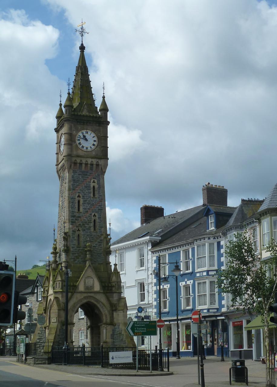
Einen unübersehbaren Akzent im Stadtbild von Machynlleth setzt an der Kreuzung der beiden Hauptstraßen ein neugotischer Uhrturm aus viktorianischer Zeit. Er wurde im Jahr 1873 wie in so vielen walisischen und englischen Dörfern anstelle des traditionellen Marktkreuzes errichtet, in diesem Fall zu Ehren der Markgrafen von Londonderry. Die Familie hatte ein Landhaus in dem Ort geerbt, das sich heute im Besitz der Stadt befindet.


Seit den 1970er Jahren entwickelte sich Machynlleth zu einem Anziehungspunkt für die Alternativszene, dort siedelte sich u.a. 1974 das Centre for Alternative Technology und mehrere Firmen, die sich der Nutzbarmachung regenerativer Energien widmen, an. Zum Centre for Alternative Technology gehören sowohl der Quarry Shop, ein kleiner Laden mit Ökoprodukten sowie das Quarry Cafe. Ein historisches Gebäude ist das Haus Llys Maldwyn, 1852 erbaut, heute Wohnhaus des Fotografen Mark Robert Davey. Bis 1892 war es eine Schule, danach wurde es ein kleines Stadtkrankenhaus.
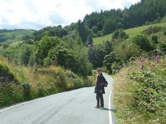
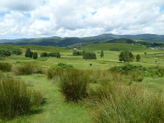
Da wir das Centre schon vor vielen Jahren besucht haben, entschließen wir uns zu einet kleinen Wanderung - gemäß einer Broschüre aus unserem Häuschen:
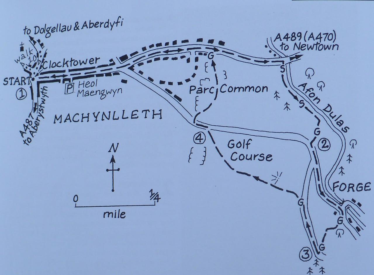
WALK 11
FORGE & THE GOLF COURSE
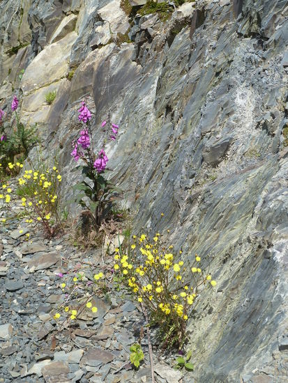
From the Clock Tower walk along Maengwyn Street, continuing ahead when the road forks to the right opposite a fish & chip shop. Pass the access road to the golf club, pass an electricity substation and then turn RIGHT down steps at a break in the crash bamer, before the road crosses the river. Veer left to walk beside the river and when you reach a ladder stile, cross it and continue beside the river. When you reach another stile, CROSS it and continue. You then approach farm buildings, where you turn right to walk beside them, then turn LEFT to go through a gate. Thurn RIGHT to walk up to a road. Turn LEFT, cross the road when it is safe to do so, and continue. When you reach a road junction by the bridge in Forge, continue AHEAD for a few paces to reach a gate on the right. There was a bronze age mine in Forge called Ogof Widdon, the Witches Cave. Then; were also five fulling mills, or pandys, taking their power from the Afon Dulas, but the last closed in 1937. Electricity used to be generated at Dolgau Farm - with the system being setup in 1931. Go through and turn half-LEFT to walk uphill on a fine green track, which soon veers right, then left" and continues to climb to reach a gate at the top of the field.
Go through the gate and turn right to walk along a lane. When you reach two gates ahead, go through the left-hand one, leaving the road and follow a track with a fence to the right and soon a great view ahead. 'Down through the golf course.
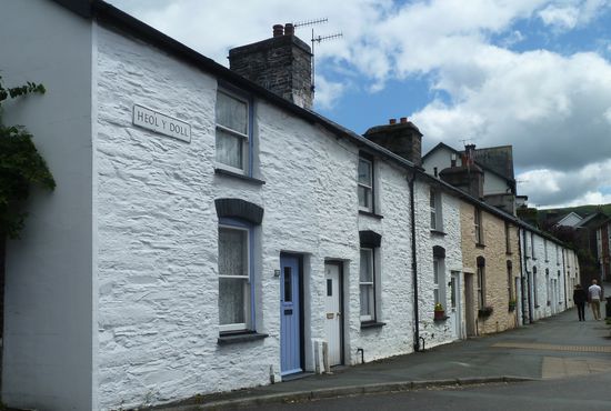
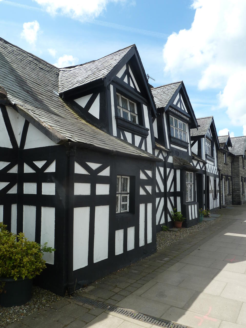
When you reach the road, turn LEFT ' and walk along the road to a cattlegrid to return to the start, first passing the Old Court House on the left- an inscription on the building reads -3628 Owen Pugh io uxor', with the date marking the rebuilding of an earlier structure. 'Uxor' is Latin and means wife, but apparently there is no established translation for 'io'. This was once the court house for the Lordship of Cyfeiliog - and the Old Parliament House on the right - 2004 was the six-hundred-years anniversary of the crowning of Owain Glyndwr as Prince of Wales in Machynlleth, and it was near here that he held a parliament. Although having been rebuilt, the building on the left is a fine example of a late medieval Welsh town house, one of only eight Grade I listed buildings in Montgomeryshire. It contains a GIyndwr exhibition. The Institute, on the right, was built in 1911, although it appears to be much older. The toll stones which once stood in Pentrerhedyn Street and Doll Street are kept upstairs.


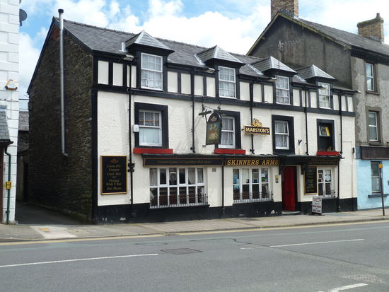
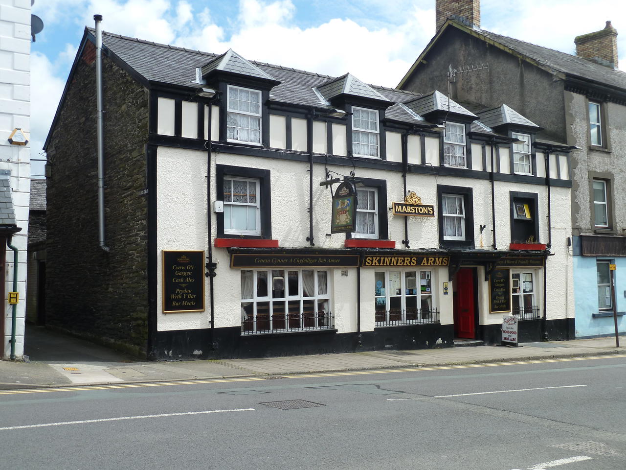
Da wir heute Sonntag haben, müssen wir natürlich die Gelegenheit nutzen in einem Pub sunday roast zu essen. Im SDkinners Arms gibt ein - two courses sunday roast - small and large. Wir nehmen small, damit wir auch die 2. kleine Wanderung noch schaffen.
Einmal beef, einmal turkey, zweimal apple crumble, dazu ein Lager und ein schreckliches Bier. (meine englischsprechende Ehefrau hat sich vertan, sie wollte mir ein Guinness bestellen.?!)
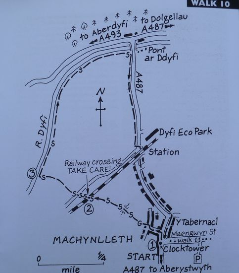
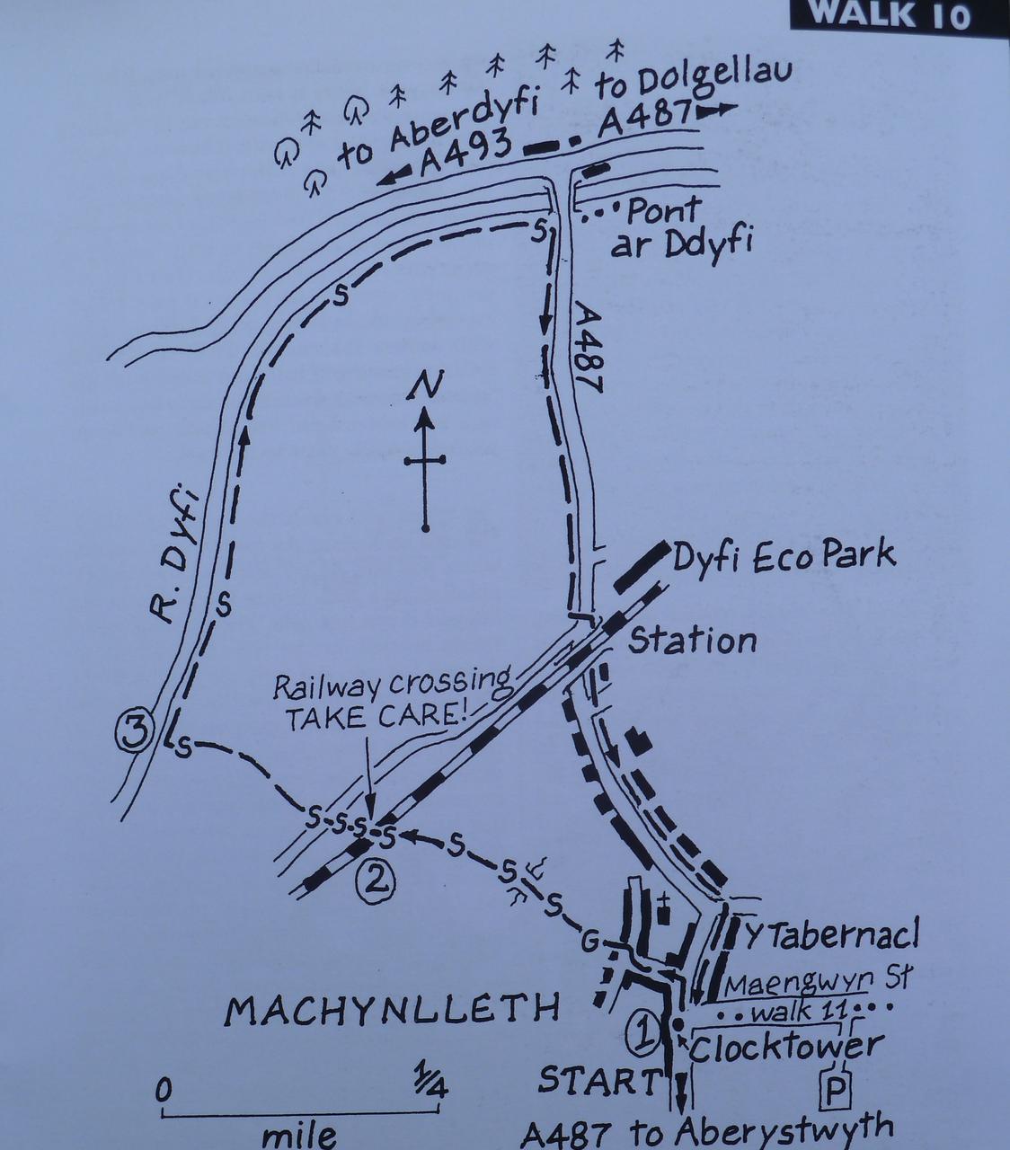
WALK 10
SALMON, SEWIN & THE DYFI BRIDGE
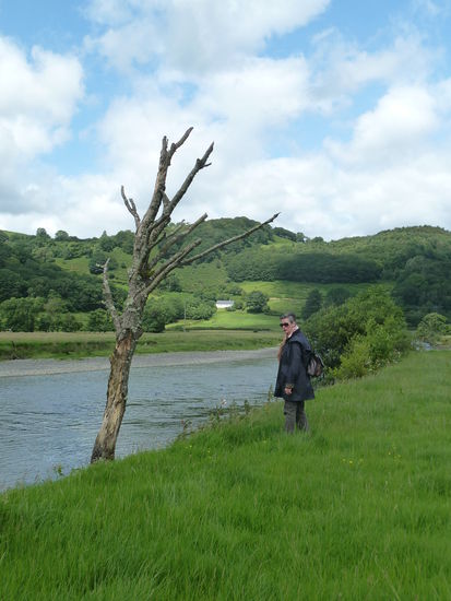
It takes no time at all to enter open country down by the Dyft, and soon you will be enjoying a stroll beside one of Wales' best salmon and sewin (wild sea trout) rivers. When the fish are 'running in the late summer and autumn you may well see them forging a way upstream to their spawning grounds. Salmon are still caught under licence by hand drawn net near the escuary - indeed it is one of the fast rivers in Wales where wild fish can be taken and sold on. From Pont ar Ddyfi you return across the flood plain, with fine views up and down the valley. An easy 1 3/4 miles, so a!!ow about an hour
START
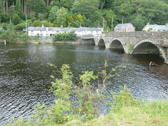
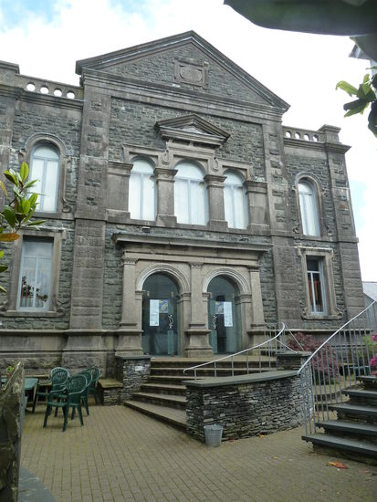
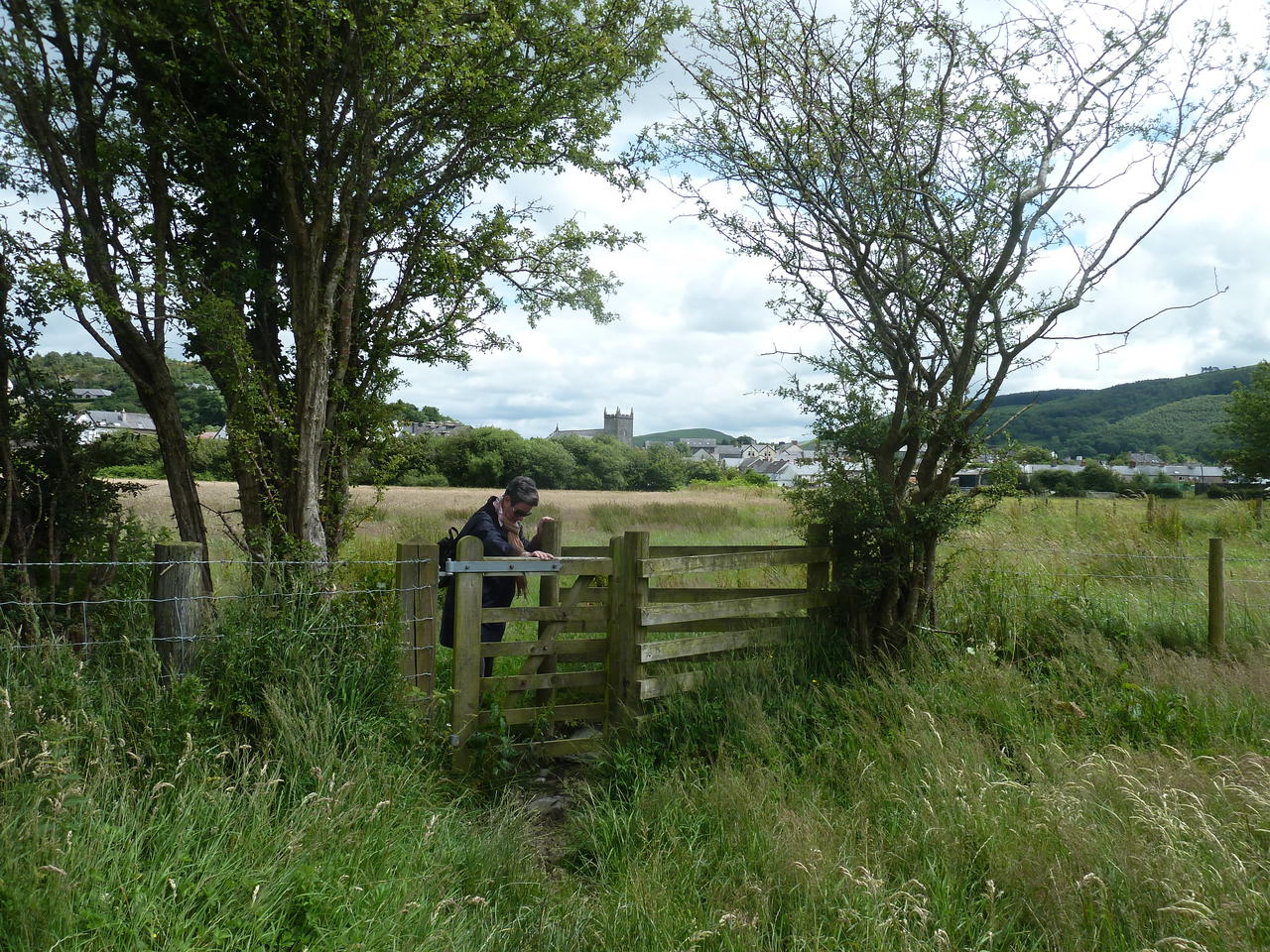
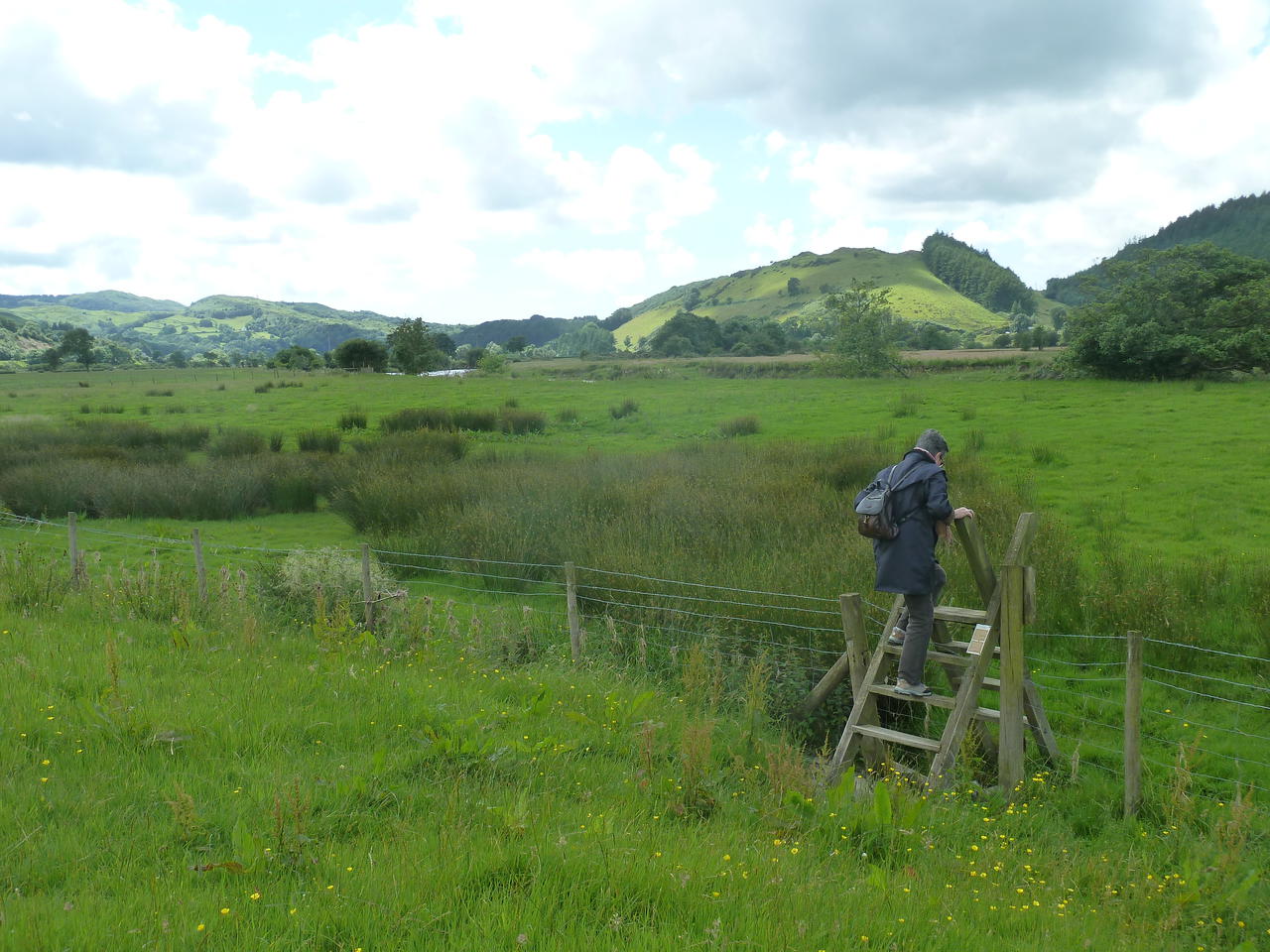
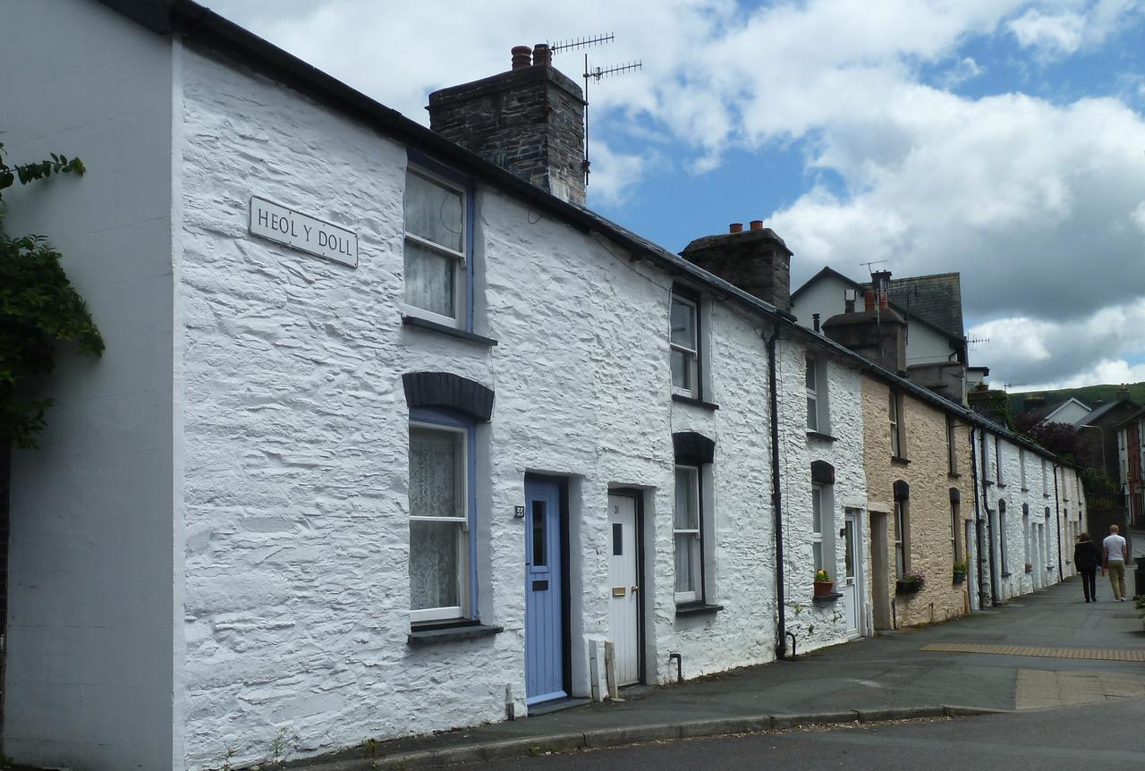
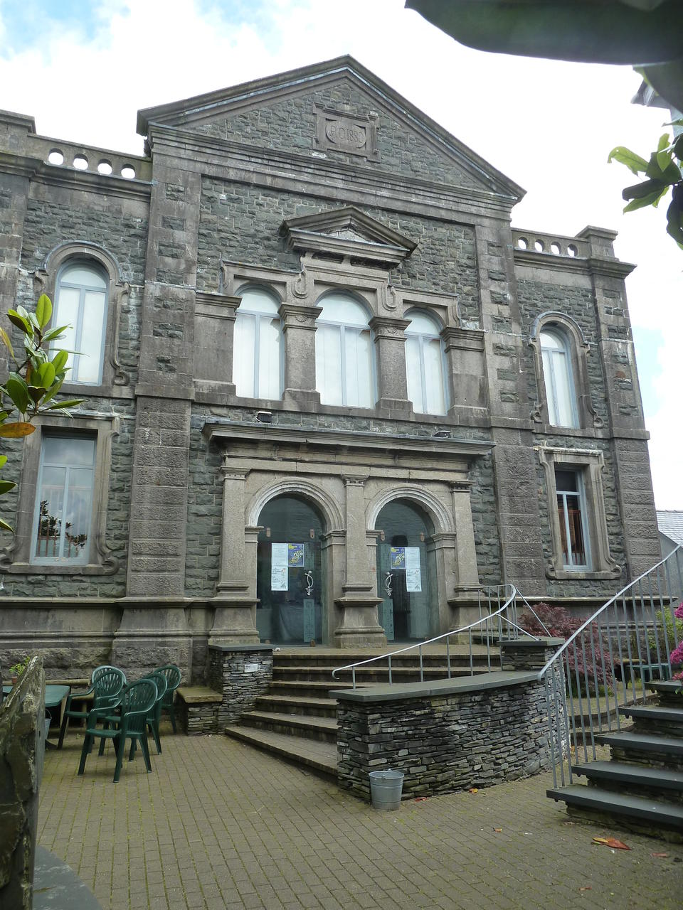
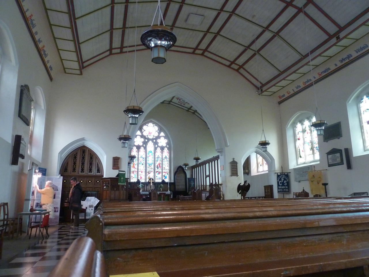
From the Clock Tawer walk towards the Station and take the first LEFT by Royal House, to walk down the Garsiwn. Royal House recently underwent extensive renovation. It is believed to be the oldest surviving building in Machynlleth, although the front was altered in the 19th-century to accommodate a shop. David Cam, who attempted to assassinate Owain Glyndwr, was imprisoned here between 1404-12, and tradition has it that Charles I stayed here in 1643. An ancient well has been discovered. Garsiwn translates as 'Garrison', and recalls a time when soldiers assembled here around 1570 before going to Ireland. The Carsiwn Well would have constituted an important water supply for the men and their horses. The Corris Tramway, which connected the Corris Steam Railway with the port of Derwenlas, once ran across Garsiwn Square, It was first used in 1859, the carriages being horse drawn. Turn RIGHT at the bottom then veer left to walk between houses in the far left-hand corner of a 'triangle'. Walk down a narrow path between houses (ignore the field gate on the left) to go through a metal kissing-gate and enter a field. Now walk with the fence to your left. cross a stile and coiitinu« with a ditch to your left to reach a rough bridge and a stile. Cross these and continue to another stile ahead - and don't forget to turn around for an unsual view of the Machynlleth skylionee. It can be quite muddy here during wet weather Cross this and maintain your direction towards the railway and a prominent crossing sign. Cross a stile and climb up to the tin«, then STOP. LOOK AND LISTEN. Only when you are certain it is safe to to so. cross the line and walk down to the stile opposite» and cross this Follow the path through *apatch of rough ground and cross a stile to join a track. Now cross a ladder stile opposite to walk on a concassionary path between field boundaries on Tir Gofal land, where access with a dog may be restricted during lambing time. When you reach an open field veer LEFT to reach another ladder stils. Cross this and carry on ahead to reach the Afan Dyfi. Turn RIGHT and walk with the river to your left. Cross a stile and continue to eventually reach another stile, which you cross. Carry on to reach a stile beside Pont ar Ddyfi. Cross this and turn RIGHT to walk along the dedicated roadsids track towards Machynlleth. There are good views up and down the Dyß Valley, and you will also see the interesting buildings of the Dyfi Eco Park. When the track ends just before the railway bridge and station carefully cross the road and negotiate your way to the raised pavement under the bridge. Continue back towards the Clock Tower, passing the War Memorial and the Tabernacl on your left. Tabernacl opened in 1986 as a centre for the performing arts, the Tabernacl hosts concerts throughout the year. and a renowned festival in late August. The beautiful auditorium holds 400 people seated on pitch pine pews, where they, and the performers, revel in the buiilding's perfect acoustics. The Museum of Modeen Art Wales has six elegant exhibition spaces, hosting the Tabernacl Collection of Modern Welsh Art and a series of temporary exhibitions. There are workshops,and an annual art competition.


| Aufbruch: | 09.07.2012 |
| Dauer: | 14 Tage |
| Heimkehr: | 22.07.2012 |
