Neun kleine Inselchen - die Azoren
Insel Sao Miguel: Das brodelnde Tal von Furnas
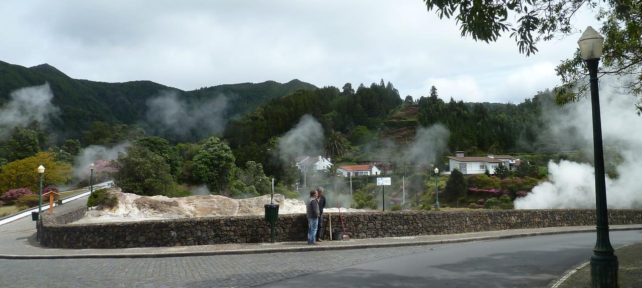
Danach gebe ich Furnas ins Navi und wir fahren 10 km durch eine traumhafte Parklandschaft, mit bis 4 m hohen Kamelienbäumen bis wir im Tal Dampfschwaden aufsteigen sehen.

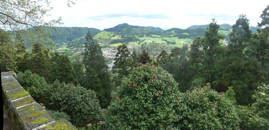
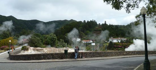
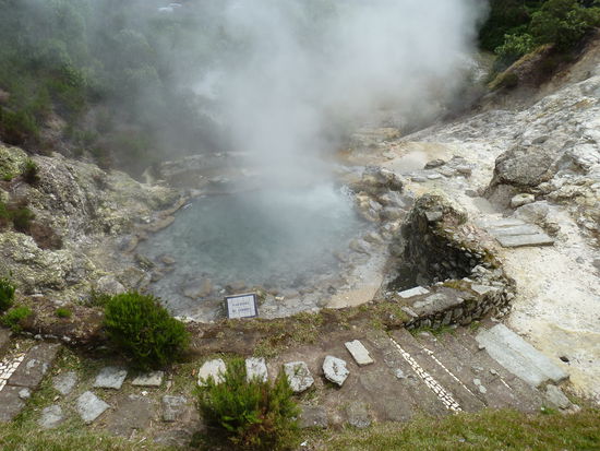
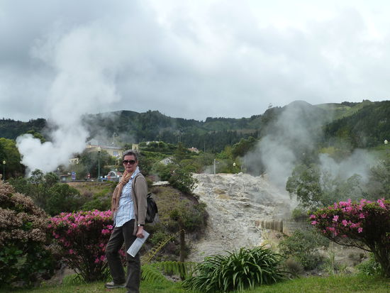
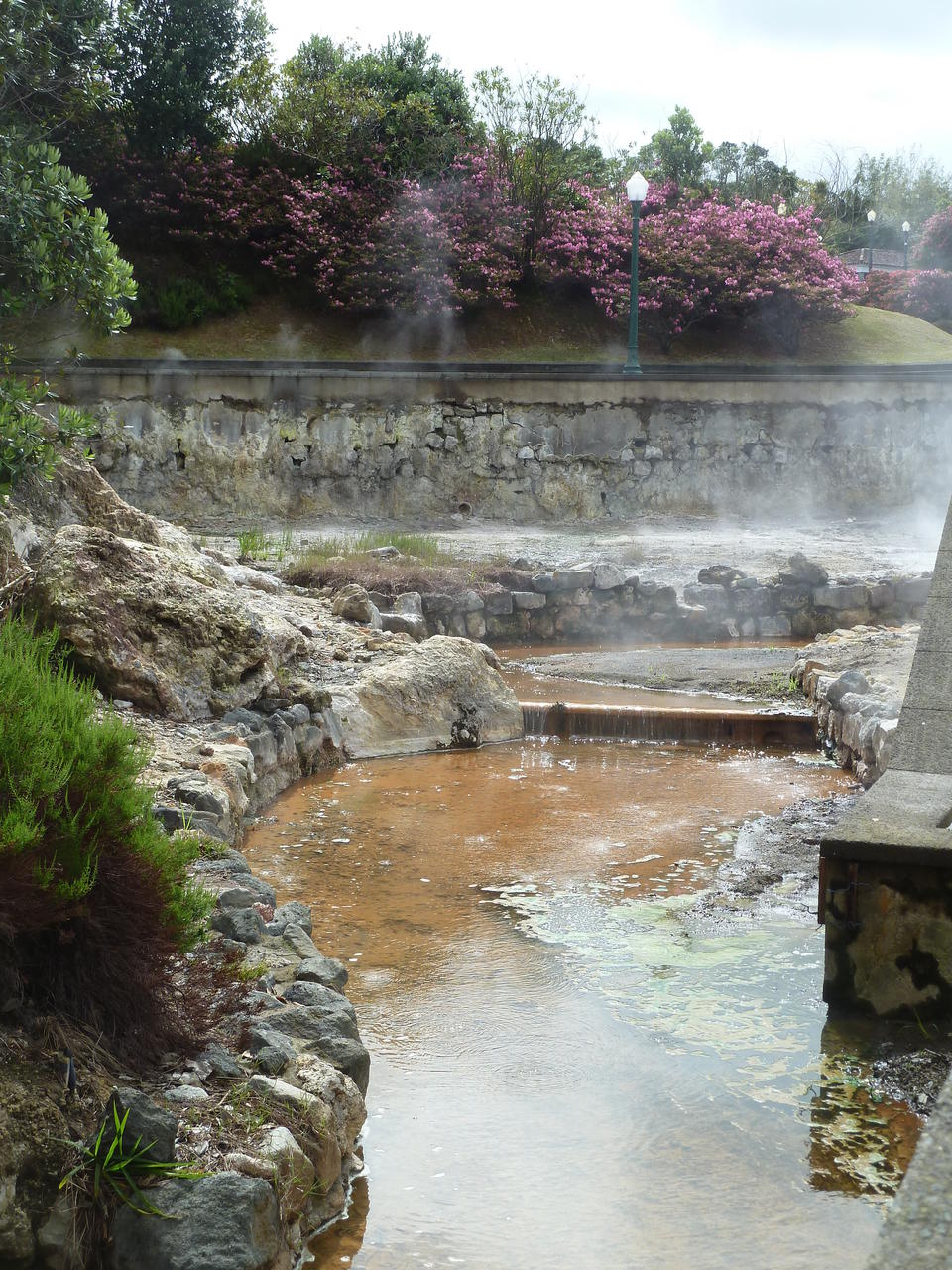
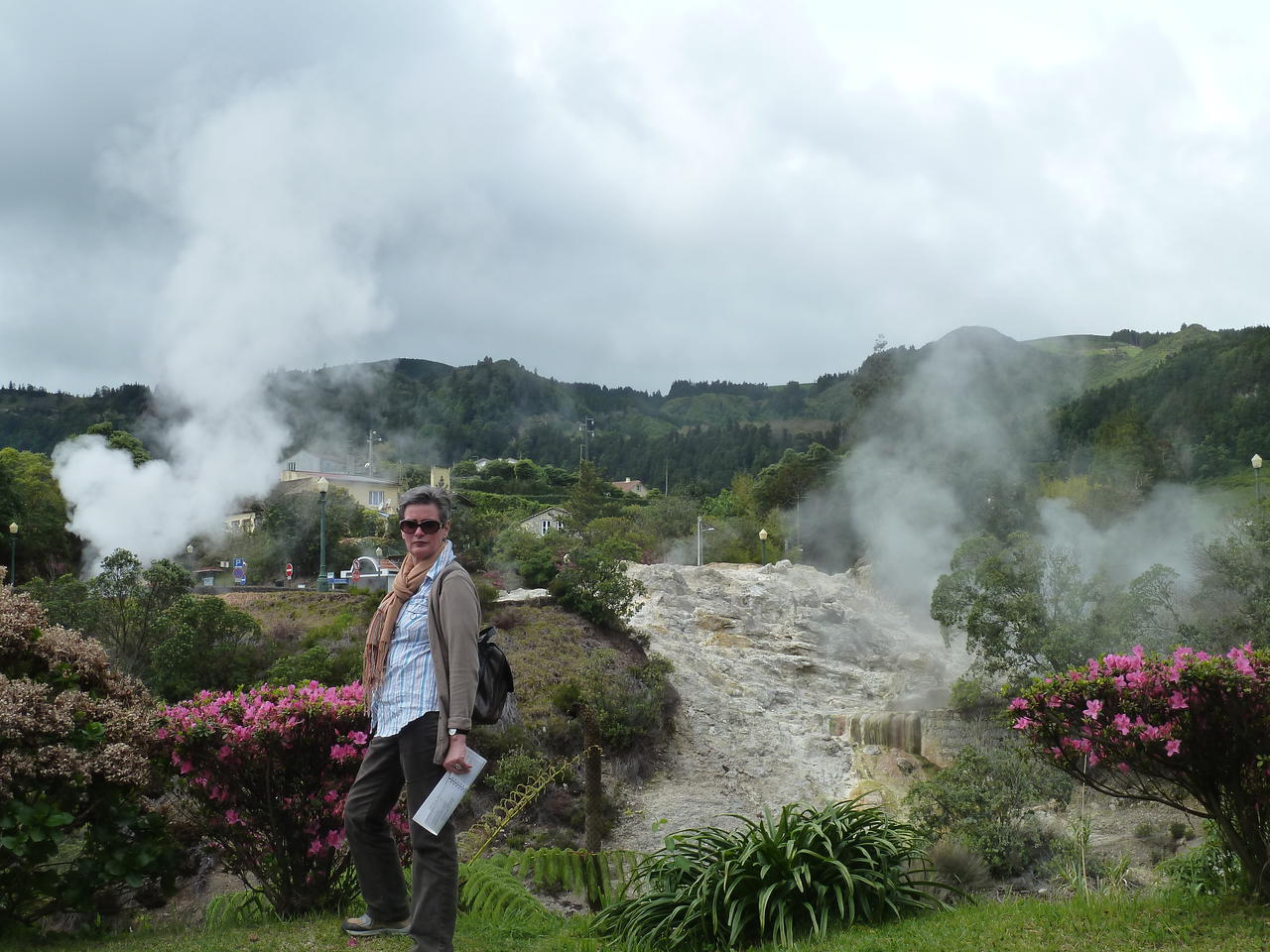
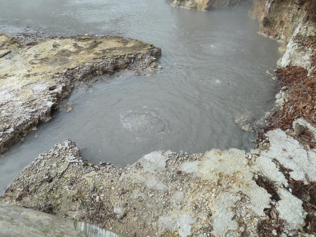
Dort sind die Caldeiras von Furnas - mitten im Ort brodelt, dampft und sprudelt es - außerdem ist der in unserer Heimatstadt bekannte 'Duft' von Schwefelwasserstoff wahrzunehmen.
Die Caldeiras von Furnas mit
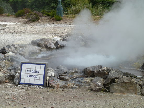
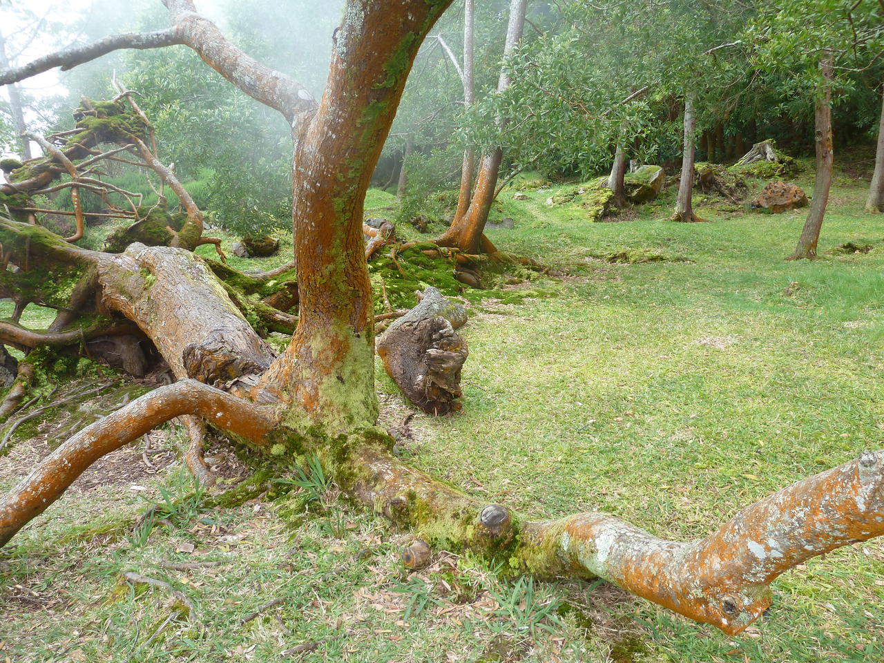
Fumarolen, Geysire, brodelndem Wasser und medizinisch nutzbarem Schlamm, sind Zeugnis der verschiedenartigsten vulkanischen Tätigkeiten. Die caldeira de Pero Botelho ist wohl die spektakulärste, da es nicht nur dampft und brodelt, sondern auch noch donnernde Geräusche zu hören sind. Das Furnastal, das von zwei Flüssen durchquert wird, einer mit kaltem und einer mit warmem, rostfarbigem Wasser, ist mit seinen 22 Thermalquellen eine der wasserreichsten Gegenden Europas. Im Ort gibt es ein bedeutendes Kurbad, wo die verschiedenen Wasser und der schwefelhaltige Schlamm zur Behandlung von hauptsächlich allergischen Erkrankungen der Atemwege, rheumatischen Erkrankungen. Kreislaufstörungen u.a. medizinisch genutzt werden.
Vier virtuelle Cache gehören dazu
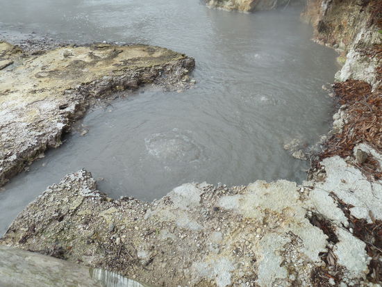
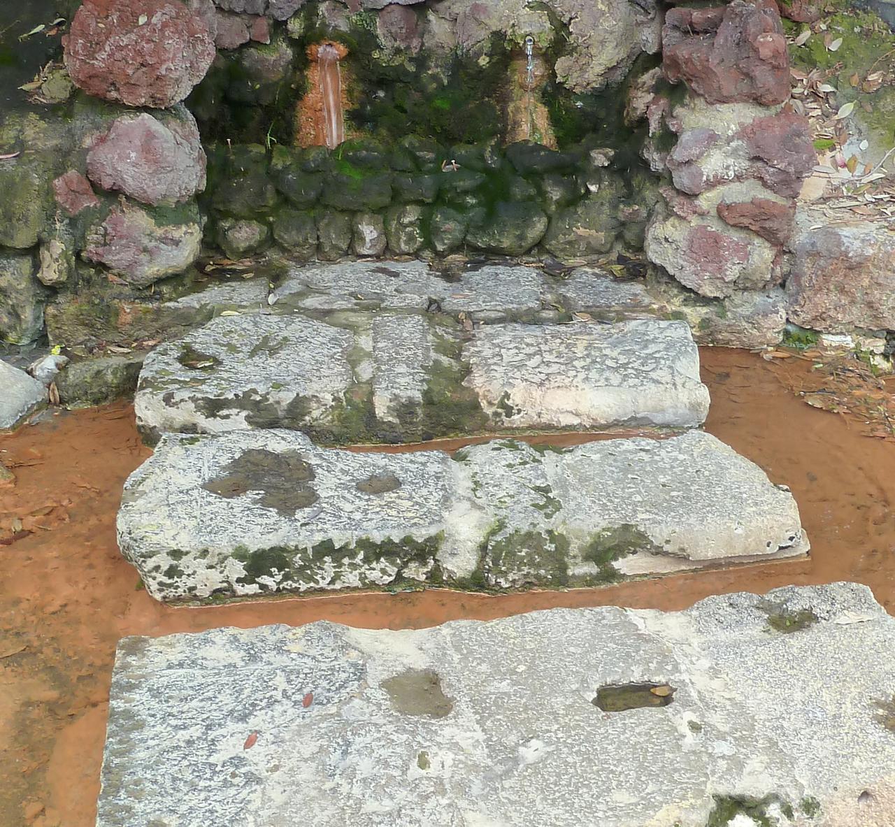
GC1PPap zwei Quellen direkt nebeneinander einmal heiß und einmal kalt - N 37° 46.398/ W 025° 18.239
Das schöne an den virtuellen caches ist, dass sie nicht stupides Döschen-Suchen verlangen, sondern - wie dieser - auf der zugörigen Webseite interessante Details verraten, die über den Reiseführer hinausgehen, und dann halt ein paar Fragen dazu stellen. In diesem ist vor allem die Karte des Meeres interessant, die deutlich macht, dass die Azoren ein ganz sensibles Gebiet sind, da hier drei Platten (Nordamerika-, Afrika- und Eurasiaplatte aneinanderstoßen. .
"This EarthCache takes you to investigate the ground water of one of the Azores tourist hot spots: the Furnas volcano on the Island of S. Miguel. Ground zero takes you to a fountain that is made up of two spouts each with their own proper name. In order to qualify for a found, please tell me a) what the names of the spouts are, b) which spout yields HOT water and c) whether the temperature of this water is below or above 36.3 ºC. "

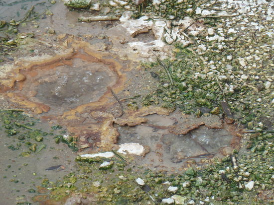
um die Lösungen hier nicht zu verraten, ist das Bild 'oben' beschnitten - deutlich zu erkennen: eine 'Quelle' ist für die hellbraune Farbe verantwortlich
GC1NGDW -
Geological setting of the Furnas volcano:
"Furnas is the easternmost of the three active central volcanoes on the island of São Miguel in the Azores. Unlike the other two central volcanoes, Sete Cidades and Fogo, Furnas does not have a well-developed edifice, but consists of a steep-sided caldera complex 8*5 km across. It is built on the outer flanks of the Povoação/Nordeste lava complex that forms the eastern end of São Miguel.
Constructive flanks to the volcano exist on the southern side where they form the coastal cliffs, and to the west. The caldera margins tend to reflect the regional/local tectonic pattern which has also controlled the distribution of vents within the caldera and areas of thermal springs.
Activity at Furnas has been essentially explosive, erupting materials of trachytic composition. Products associated with the volcano include plinian and sub-plinian pumice deposits, ignimbrites and surge deposits, phreatomagmatic ashes, block and ash deposits and dome materials.
Most of the activity has occurred from vents within the caldera, or on the caldera margin, although strombolian eruptions with aa flows of ankaramite and hawaiite have occurred outside the caldera. The eruptive history consists of at least two major caldera collapses, followed by caldera infilling. Based on 14C dates, it appears that the youngest major collapse occurred about 12,000-10,000 years BP.
New 14C dates for a densely welded ignimbrite suggest that a potential caldera-forming eruption occurred at about 30,000 years BP. Recent eruptions (<5000 years old) were mainly characterised by alternating episodes of magmatic and phreatomagmatic activity of plinian and sub-plinian magnitude, forming deposits of interbedded ash and lapilli. An historical eruption is documented in 1630 AD; new evidence suggests that another occurred during the early occupation of the area at about 1440 AD.
The cache:
To claim this EarthCache you need to perform two tasks.
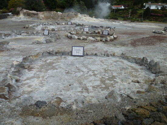
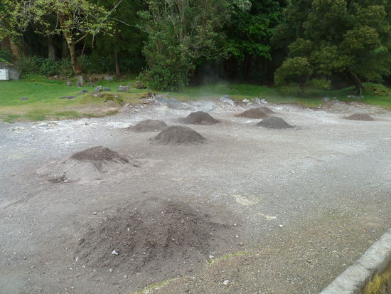
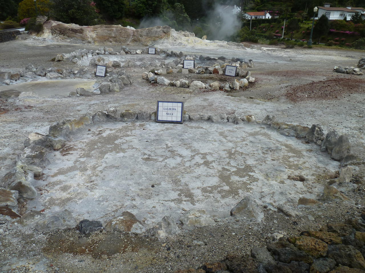
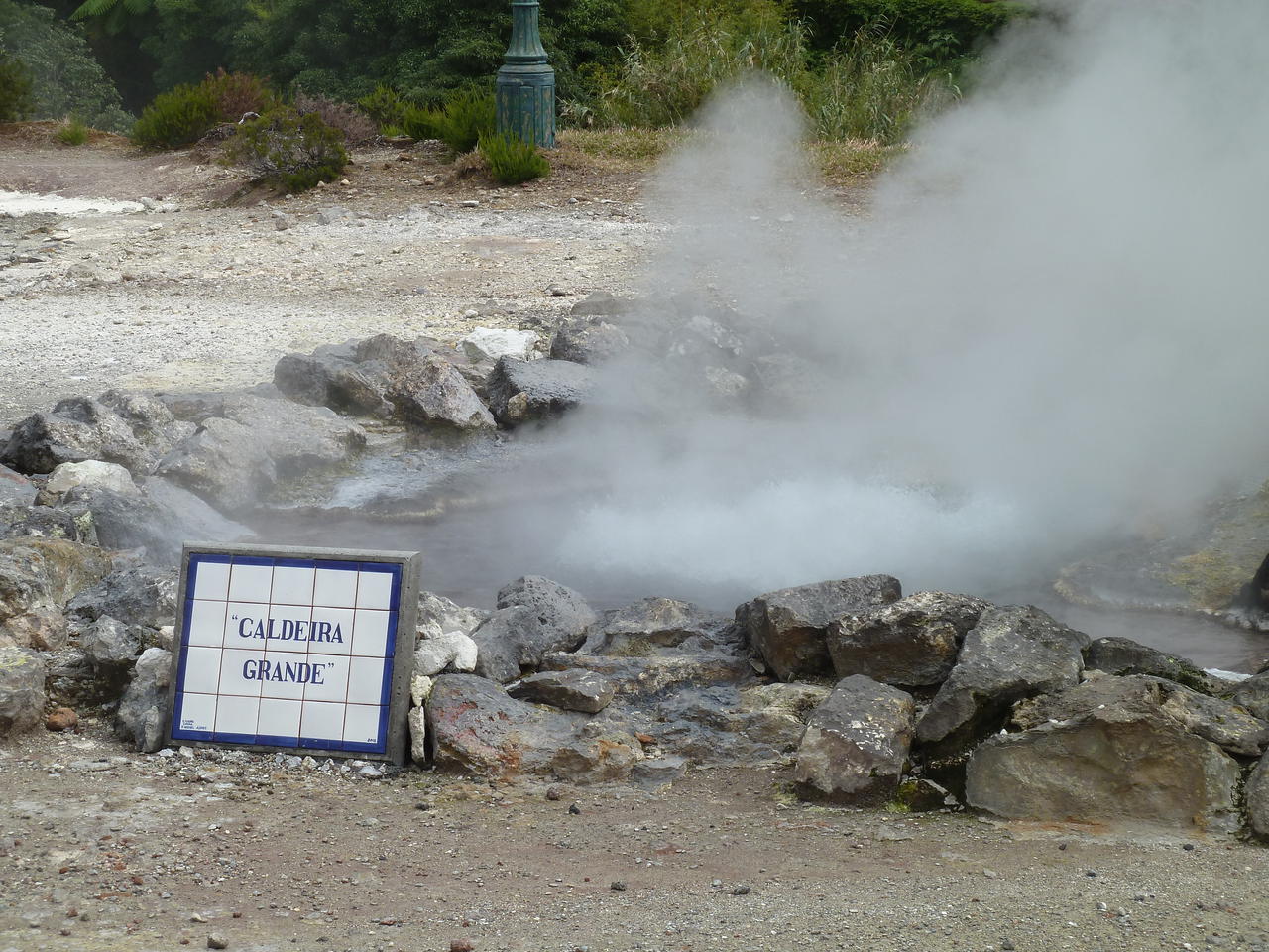
Go to the given coordinates and tell me how many fumaroles are present here, if they emit steam and sound and what shape are their openings.
However, you must take a picture of yourself near the tile panel at N37º 46.377' W025º 18.266 (78 m to the east of GZ), and incluede this photo in your log."

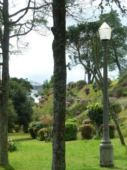
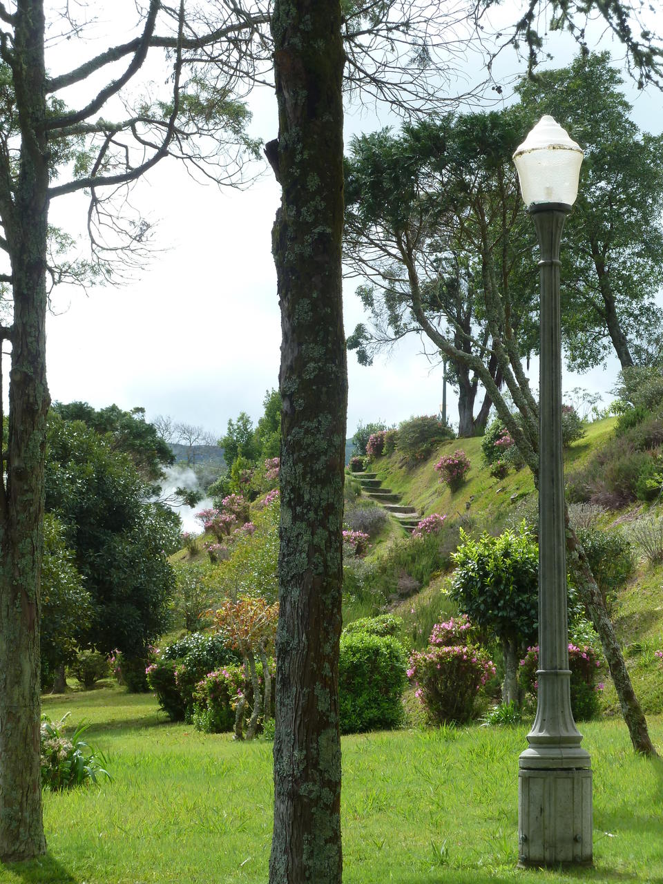
Der schöne Park an den Fumarole lädt ebenfalls zu einem Rundgang ein.
Wer noch etwas mehr sehen möchte, kann sich meinen Videoclip über Furnas auf youtube anschauen.
Die beiden anderen Caches liegen etwas weiter entfernt.
Am
GC2Z1RH - Pool Dona Beija - 2€ Eintritt - fängt es an zu nieseln, daher laufen wir nicht durch den Park und können natürlich auch nicht loggen.
Doch nur wenige Kilometer weiter liegt der nächste Earth-Cache
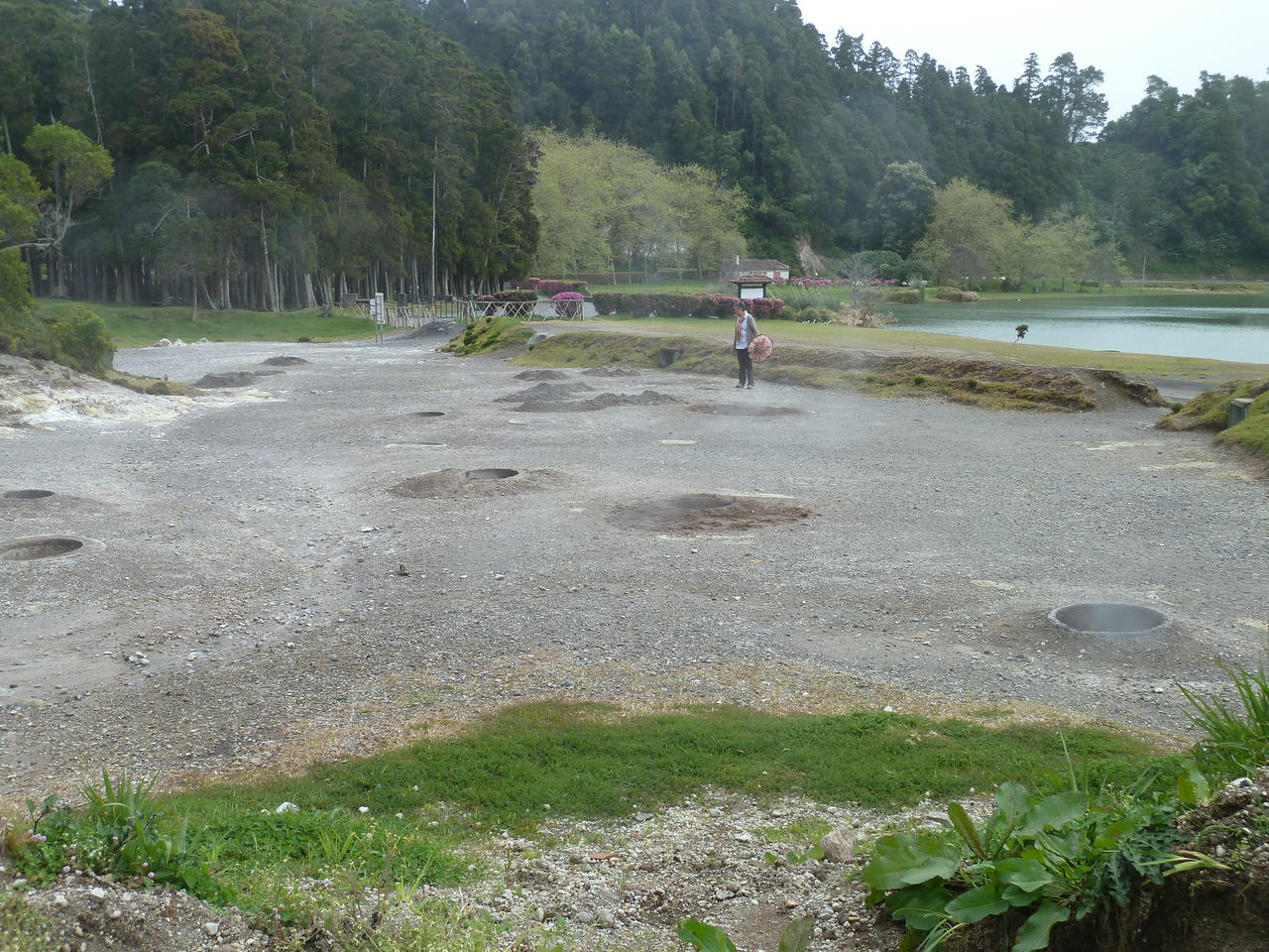
GC35DK2 - am See von Furnas.
N 37° 46.095 W 025° 19.880
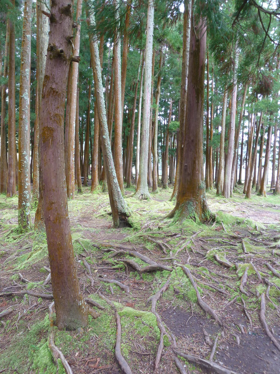
Vom Parkplatz läuft man durch einen vermoosten 'Märchen'wald zum Seeufer, wo es wieder kräftig dampft.


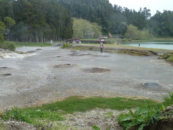
Ulrike zählt schon die Erdlöcher (Aufgabe des Caches), in denen das 'furnas meat stew' gekocht wird.
"Manifestations of secondary volcanism
Some secondary manifestations of volcanism are the fumaroles, the sulfates and geysers. At the end of an eruptive phase, in the crater of the volcano or in its vicinity, there are sometimes gas emissions at high temperatures called fumaroles. These issues always contain water vapor made by other gases such as sulfur compounds - Sulphated - or carbon dioxide - Mofet.
A fumarole (Latin fumus, smoke) is an opening in Earth's crust, often in the neighbourhood of volcanoes, which emits steam and gases such as carbon dioxide, sulphur dioxide, hydrochloric acid, and hydrogen sulphide.
Fumaroles can occur on the surface of lava flows and thicker pyroclastic flows. The flows require a release of heat to cool off. Small cracks and crevices in the crust also allow steam from deeper within the Earth to escape. Fumaroles can be present singularly or in large fields full of them.
Depending on the heat source, fumaroles can be short or a long term feature. The hotter the heat source is, whether it be an internal rock mass or a volcanic flow, the longer it will take to cool off, so the longer the fumarole will exist. A fumarole field is an area of thermal springs and gas vents where magma or hot igneous rocks at shallow depth are releasing gases or interacting with groundwater. From a simplistic point of view and the perspective of groundwater, fumaroles could be described as a hot spring that boils off all its water before the water reaches the surface.
Furnas meat stew
This is one of the most emblematic dishes of the island of S. Miguel in the Azores, baked beneath the earth in the Furnas lagoon. Several ingredients are placed in a pot that is buried next to the hot water springs. It takes five hours to bake them by the natural heat that seeps up, produced by volcanic activity. Tasting the "geo dish" Furnas stew is an unmissable experience for all visitors of the island.
About the EarthCache:
Focusing on the secondary manifestations of volcanism , after exploring the area, you must perform three tasks:
1) Look around, how many fumaroles are there?
2) Observe closely the rocks in the ground... do you notice something special about them? Please describe what you see.
3) Now, and since this is an Earthcache inspired by the Furnas meat stew (Cozido of Furnas), let's open your appetite while you count how many holes are in the area that are used to cook this famous local dish?
Also, and despite being optional , please take a photo in GZ with your GPS and show it with your log."
Wer noch etwas mehr sehen möchte, kann sich meinen Videoclip über Lagoa de Furnas auf youtube anschauen.
Nachdem wir nun alle diese Caches mit ihren Fragen untersucht und bearbeitet haben, ist es bereits 17.00 Uhr und wir wollen noch in Ponta Delgada einkaufen. Das ist gar nicht so einfach, da wir einen Supersupermarkt an der via rapida gesehen haben, aber von der Ausfahrt dort trotz mehrfachen Umfahrens nicht erreichen. Deshalb gehen wir in einen anderen, der viel größer ist als erwartet: Sol-Mar.
Noch gute 20 km und wir sind im Haus, wo es heute für Ulrike auf aufgemüpfte Pizza gibt und ich "bacalao con natas" als convinient food bekomme. Beides ist sehr lecker. Auch der ausgesuchte Rotwein von der Insel Pico schmeckt gut.
Wir schauen uns die Tagesschau auf der ARD-Mediathek an und dann muß ich Bordbuch schreiben.
| Aufbruch: | 01.04.2012 |
| Dauer: | 15 Tage |
| Heimkehr: | 15.04.2012 |
